El Niño tracking didn’t begin until the 1950s, but Los Angeles has weathered a long history of epic storms and devastating floods. The following two slideshows cover more than 130 years of LA storms from the pre-channelization of the LA River to the previous El Niño in 1997 and the soggy rainy season of 2010.
1880-1959
From 1880-1938, flooding was common in Los Angeles, prompting channelization of the Los Angeles River to quickly shuttle stormwater out to sea.
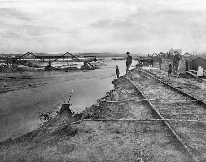
Flooding was common in the 1880s. Here, flood damage to the Santa Fe tracks on the old Downey Avenue Bridge (later North Broadway), 1885-1886
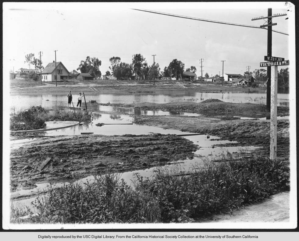
View of flooding near the intersection of 71st Street and Victoria Avenue in South Los Angeles, 1900
Rain washes away the iconic intersection at Santa Monica and Sunset Boulevard in Silverlake, 1928
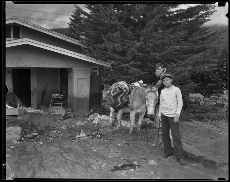
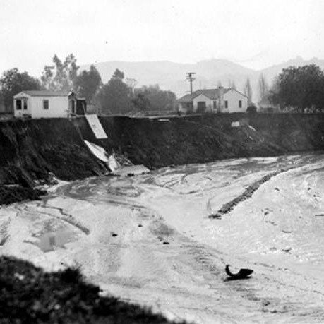
Donkey and two boys next to a house damaged by the catastrophic January flood and mudslide, La Crescenta-Montrose, 1934
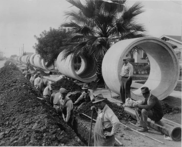
Slauson Avenue storm drain construction. Men use shovels to dig a deep trench along 69th Street, 1934
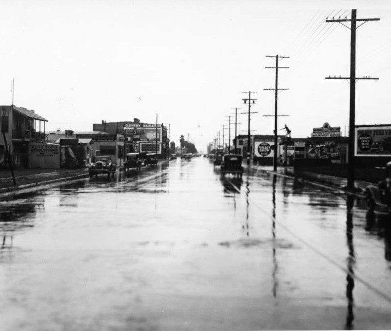
A view of unflooded Slauson Avenue west of Third Avenue after storm drain construction, late 1930s
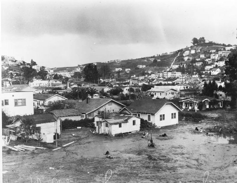
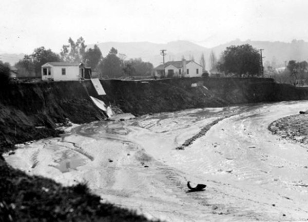
A view of North Hollywood after the Los Angeles River flood of 1938 — one of the worst floods in LA history
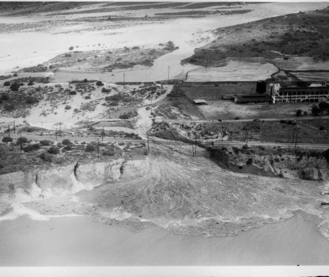
An aerial view of flooding in Azusa after rain water washes out the ground beneath the San Gabriel Railroad tracks, 1938
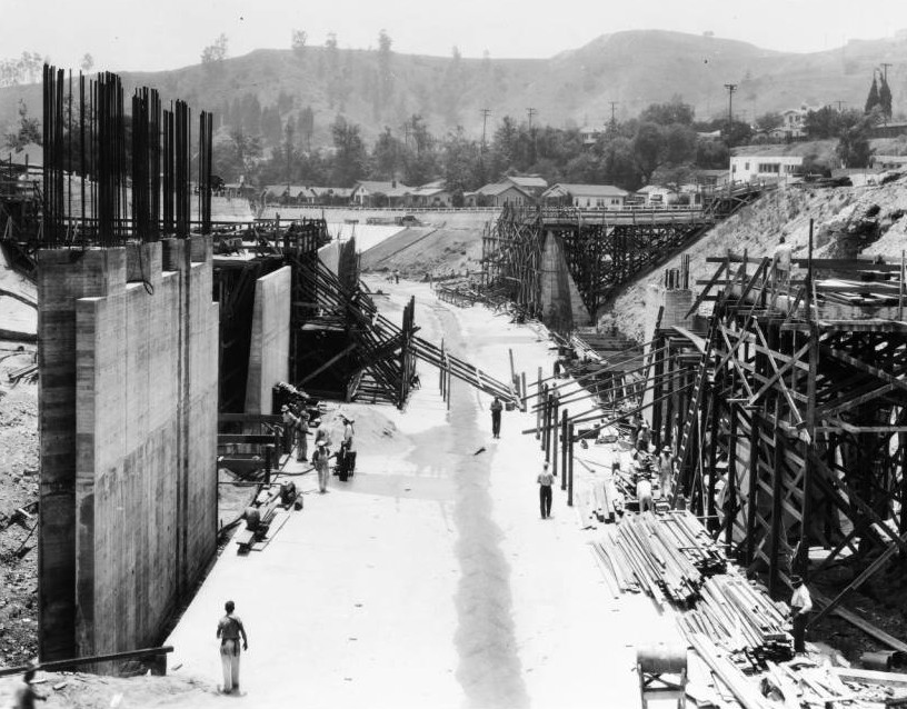
Channelization begins in earnest with the construction of a bridge across the Arroyo Seco at Avenue 43,1938
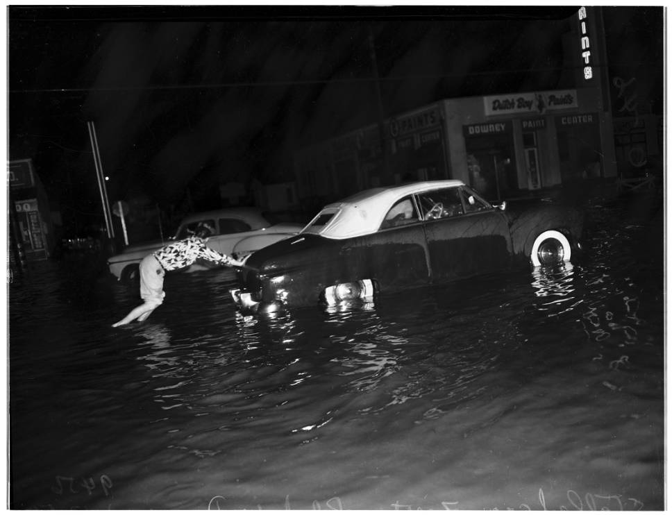
Despite channelization, flooding still occurred during heavy rains as seen here with a woman pushing her car through high water, 1952
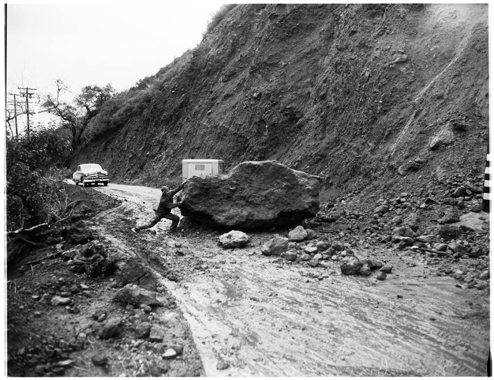
Landslides still were a problem for motorists like this man attempting to move a boulder near Pacific Coast Highway, 1952
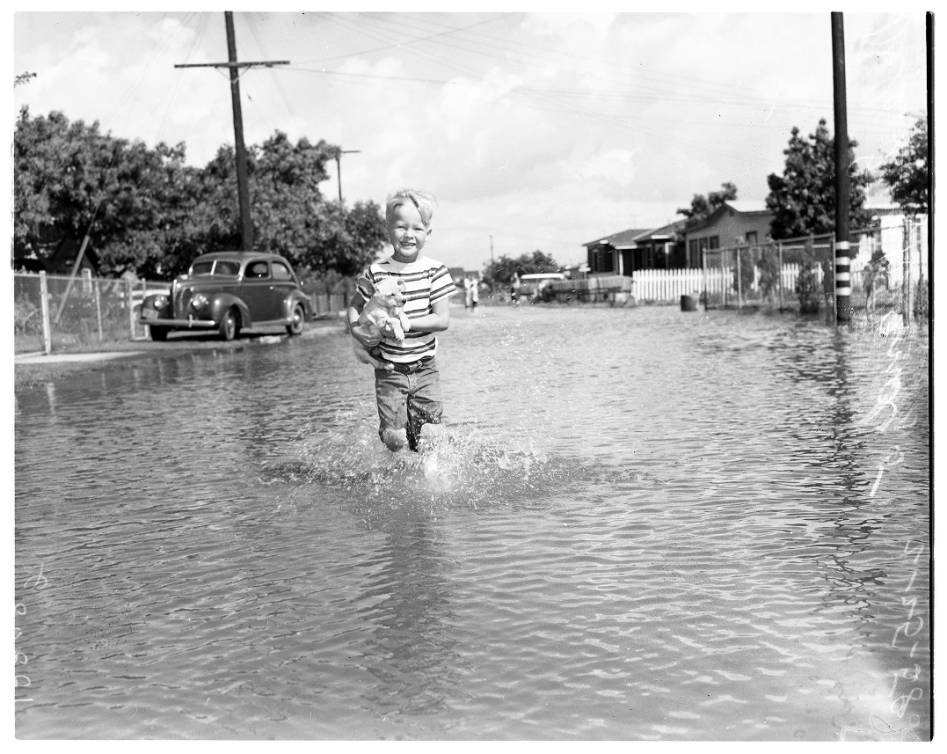
Still some people found time to enjoy the extra water like this boy with his puppy on a flooded street in Pico Rivera, 1958
1960-Present
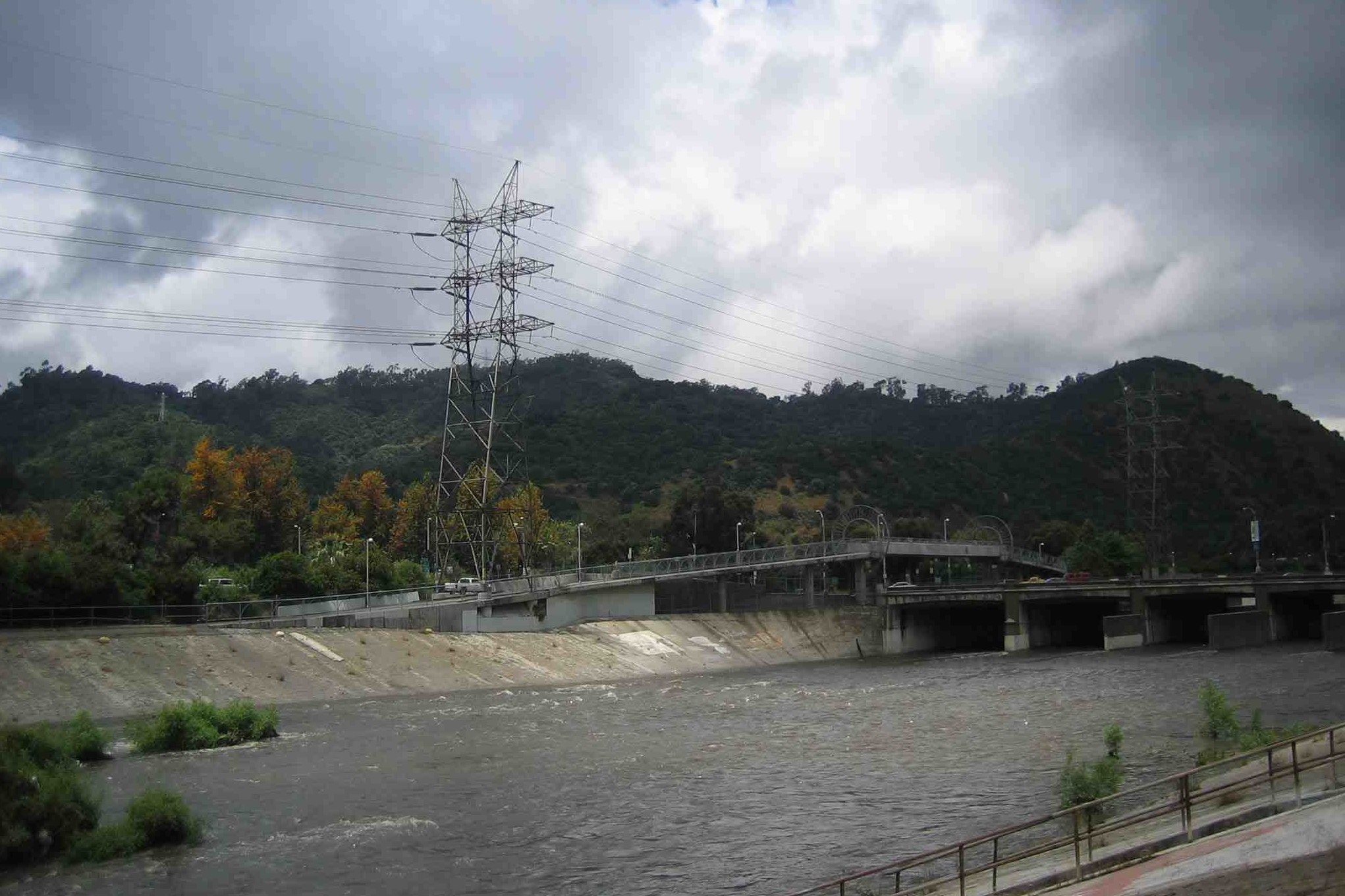
Today, miles of storm drains help flush stormwater from LA streets into our rivers, creeks and ocean. But they can still get overloaded in heavy storms.
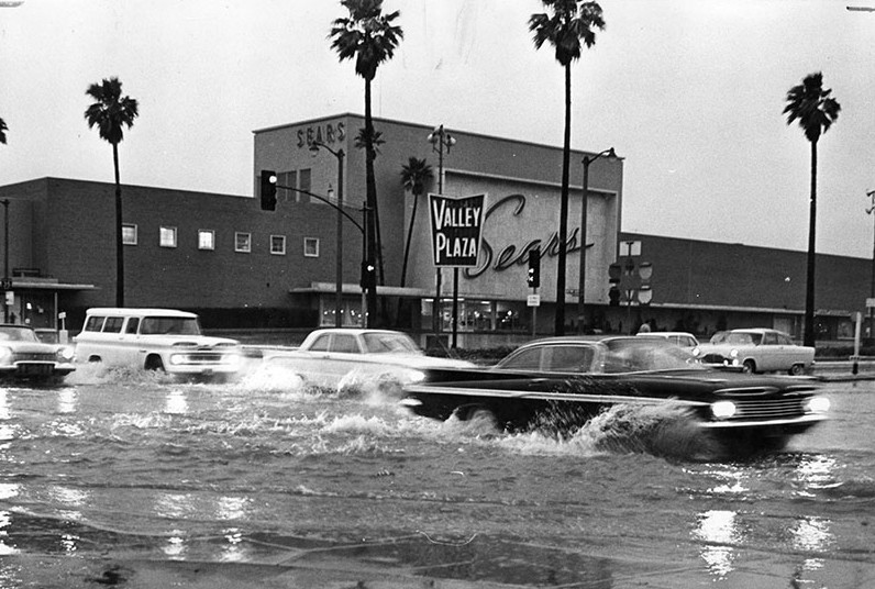
Motorists splash through flooded North Hollywood intersection at Victory and Laurel Canyon Boulevard, 1962
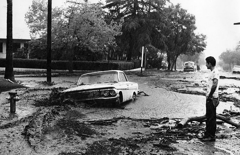
Burbank resident looks at his new car, which floodwaters and a mudslide moved 50 feet down Cypress Street, 1964
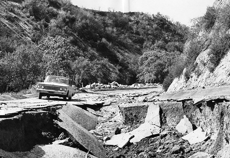
Crumbling pavement from flooding on a street in Burbank’s Wildwood Canyon Park, 1965
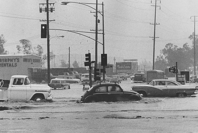
Autos navigate floodwaters on Crenshaw Boulevard in Torrance during a December storm, 1965
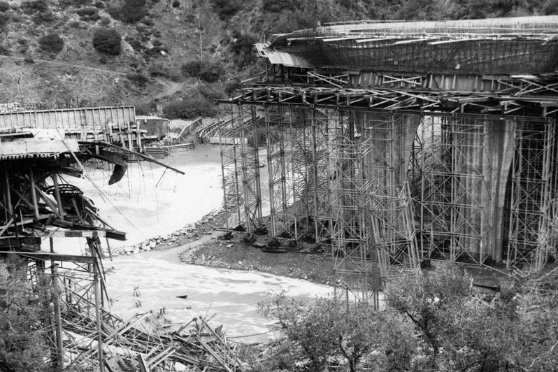
A large portion of the 210’s Foothill Freeway Bridge gave way after heavy rains north of Los Angeles, 1973.
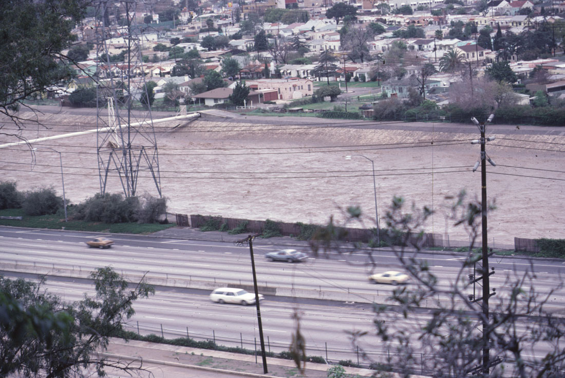
After two days of heavy rain, severe flooding causes the Los Angeles River to swell to heights rarely seen, 1978
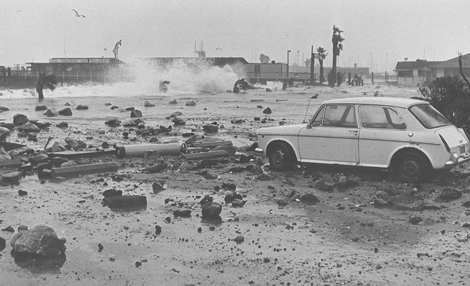
Debris-littered parking lot at King Harbor in Redondo Beach after storm-driven waves receded, 1983
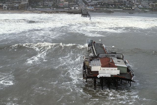
1983 brought the second largest El Niño on record. That year, storm waves destroyed a third of the Santa Monica Pier.
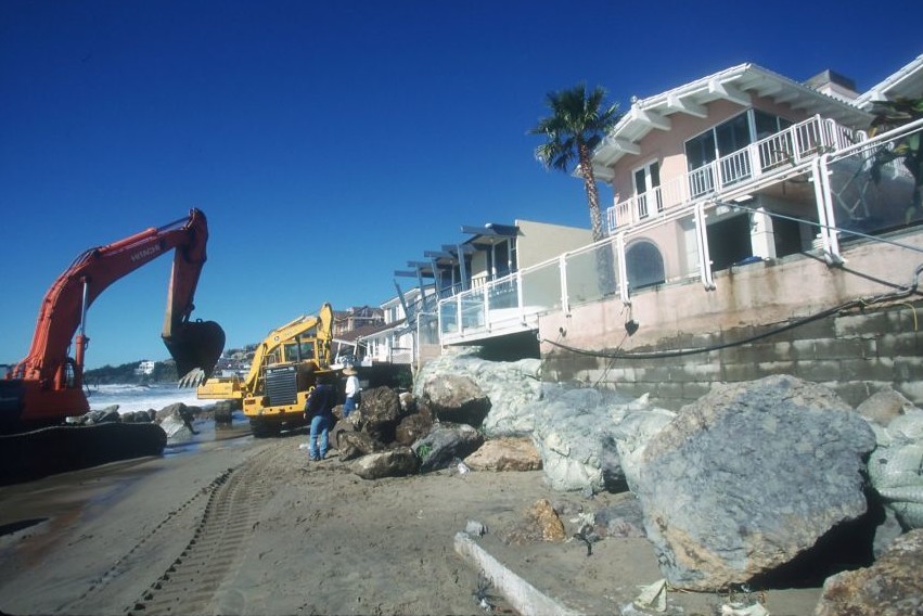
Preparing for what would become the largest El Niño year on record, construction crews protect beachfront homes with boulders, 1998
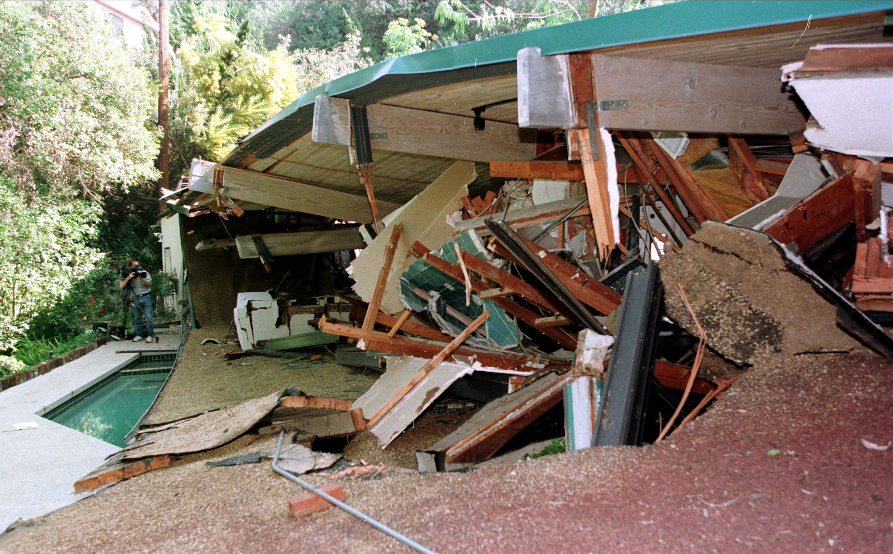
This Studio City home was red-tagged and residents were evacuated before catastrophic mudslides hit, 1998
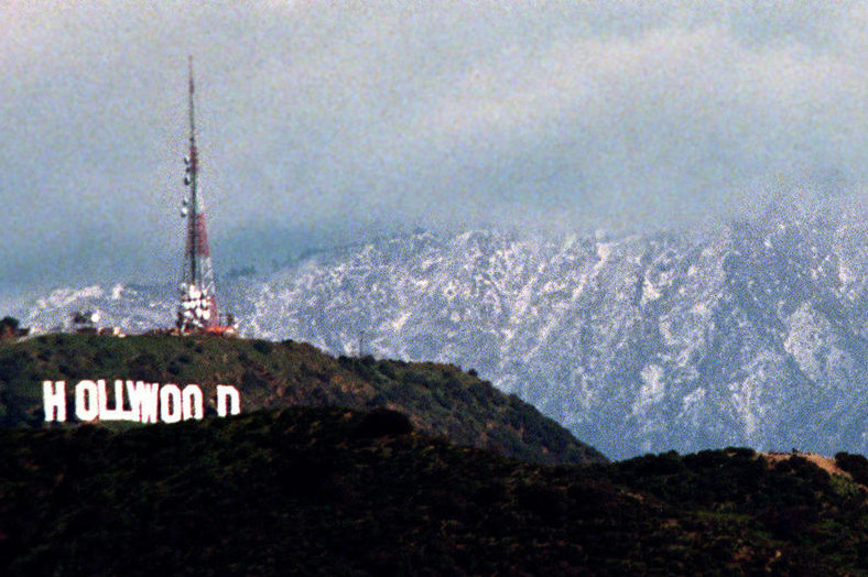
El Niño rain brings snow to lower elevations. Here, the rare sight of snow-covered mountains near Los Angeles, 1998
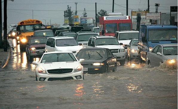
Flooding has always been common in Sun Valley as seen here in 2010. Prop O projects now divert the rainwater to replenish groundwater supplies.
El Niño may cause problems, but Los Angeles can benefit from the rain as long as we all stay safe and work together.

Share Your Comments With Us